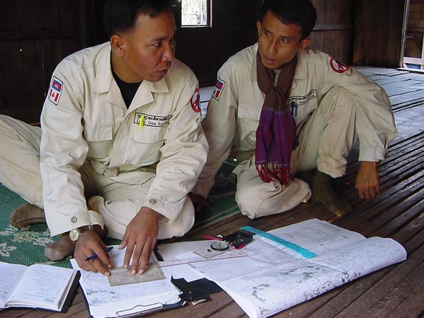
3.5 Village Survey Procedures
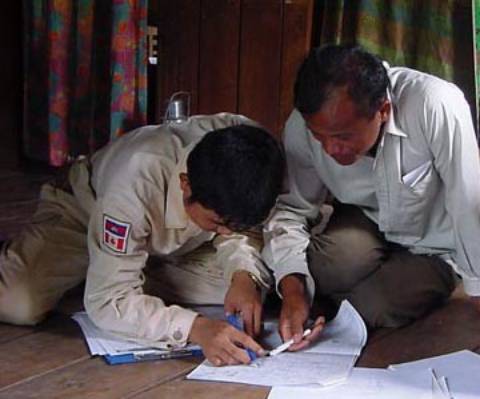
Each village was visited by one two-man survey detachment. One member of the detachment conducted the interview while the other recorded information in a diary and produced sketches when required.
Procedures are documented in the project's
Standard Operating Procedures.
In most villages, the village chief was the first person interviewed. When absent from the village the deputy village chief was interviewed. If both were absent the detachment moved to survey the next village and returned to conduct the interview on a day when the village chief was present.
Uncontaminated Villages
If the village chief informed surveyors that the village did not contain mine or UXO
contaminated areas, the information was recorded on the
Village Survey Form and confirmed as true or false by interviewing two additional residents of the village.
If the additional respondents confirmed that the village was uncontaminated, suveyors used hand-held GPS units to record the UTM co-ordinates of the village chief's house (referred to as the 'village point') as well as co-ordinates of a more permanent feature in or near the village such as a pagoda, school or large bridge (referred to as the 'village landmark').
Surveyors also questioned the village chief and two additional respondents as to any spot
UXO contamination in the village. Descriptions of the type of UXO and quantities present were recorded on a
Spot UXO Form prior to moving on to the next village to be surveyed.
On average, approximately 45-60 minutes were required to complete the survey in uncontaminated villages.
If one or both of the additional respondents interviewed disagreed with the village chief and stated that the village was contaminated with mine or UXO areas, a full survey was carried out in that village.
Contaminated Villages
If the information provided by the village chief indicated that the village did contain mined or UXO areas a comprehensive survey was undertaken in the village.
Information on village population, village poverty, impact of contaminated areas, conflict history and previous mine action in the village was recorded on the
Village Information Form.
A village sketch showing salient features in and around the villages such as roads, bridges, schools, pagodas, military installations, topographic features and mined or UXO areas was produced for each contaminated village. The location and UTM coordinates of the village point and village landmark were also indicated on the village sketch.

Information provided by the village chief regarding actual or suspected contaminated areas was recorded on the
Village Information Form. Surveyors would then identify and interview at least three residents of the village who live close to, or are in some way directly affected by each distinct mined or UXO area reported. Where possible, surveyors aimed to interview respondents of different gender, age and socio-economic class.

Information on the location, nature and history of the area, vegetation type, terrain type and soil type for each contaminated or suspect area was recorded on the
Suspected Mined (UXO) Area Form.
Data recording the ways in which each mined or UXO area impacts on the community were recorded on a
Socio-economic Impact Form.
Bio-data on mine/UXO casualties (if any) in each of the mined (UXO) areas was recorded on the
Mines / UXO Victims Form.
A suspected area sketch map was produced. UTM co-ordinates for a benchmark (a point close to but at a safe distance outside the mined or UXO areas were recorded and shown on the village sketch. Polygons representing the contaminated mined or UXO areas were also plotted on 1:50,000 scale topographic maps.
Descriptions and quantities of spot UXO and/or non-impacting cluster bombed areas affecting the village were recorded on the UXO In Village Form.
All respondents were asked to look at the village sketch to ensure that it was representative of the situation in the village and that all contaminated areas had been identified and indicated.
On average, the complete survey of a contaminated village took a full day to complete. Depending on the degree of contamination affecting a village, the survey could be completed in as short a time as a half day, or in some instances, as long as 3 days per village.
Documentation
Upon return to the team accommodations, surveyors ensured that all necessary documentation was in order before submitting the completed survey report to their team leaders. Team Leaders checked the reports for omissions and conducted 20% field checks to ensure data accuracy before in turn submitting the reports to the field office for further field checking by the operations team (1% field checks) and review by the Field Editors.
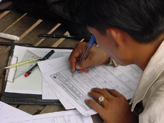
A surveyor finalises a form prior to submission
Field Editors screened the reports for common errors identified by the database staff or by team leaders, operations managers or the QA/QC team undertaking field checks. Once the reports for all villages within a district were checked, the package of reports was handed on to the QA/QC team who conducted an additional 3% field check of the questionnaires before they were finally submitted to the database unit.
Missing, incomplete or inaccurate information identified at any stage throughout this process was corrected by a review of information contained in the surveyors' diaries relative to the village in question or if necessary a revisit to the village by the detachment who originally conducted the survey.
Ensuring all necessary documentation is in order